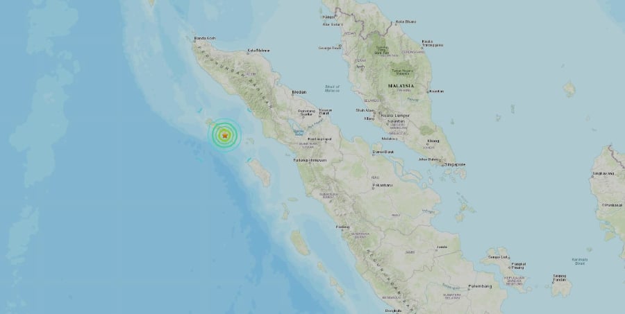
The location of the quake in Indonesia
BANDA ACEH (Sumatra, Indonesia), Jan 7 (NNN-AGENCIES) — An earthquake of magnitude 6.2 struck southwest of Indonesia’s Aceh province on the island of Sumatra on Tuesday at a depth of 20.3 km, the US Geological Survey (USGS) said.
The Indonesian meteorology and geophysics agency said on Twitter that the quake had magnitude 6.4 and a depth of 13km, adding that it did not have the potential to trigger a tsunami.
There have been no immediate reports of damage or casualties.
The epicentre of earthquake, which hit at 1.05pm local time, was in the sea 24km southwest of Sinabang town, according to the Indonesian agency’s update on Twitter.
The quake’s impact may be felt in the neighbouring North Sumatra province, particularly in the city of Medan and in Nias island, the agency added.
Malaysia’s meteorological agency said the quake was felt around Penang, and no tsunami threat towards Malaysia has been detected.
Aceh recently marked 15 years after a magnitude 9.1 Boxing Day quake hit the Indian Ocean and triggered a wave as high as 17.4m, wiping some communities off the map.
The province bore the brunt of the disaster, where a total of 128,858 people were killed, according to statistics compiled by the government and aid agencies. — NNN-CNA


