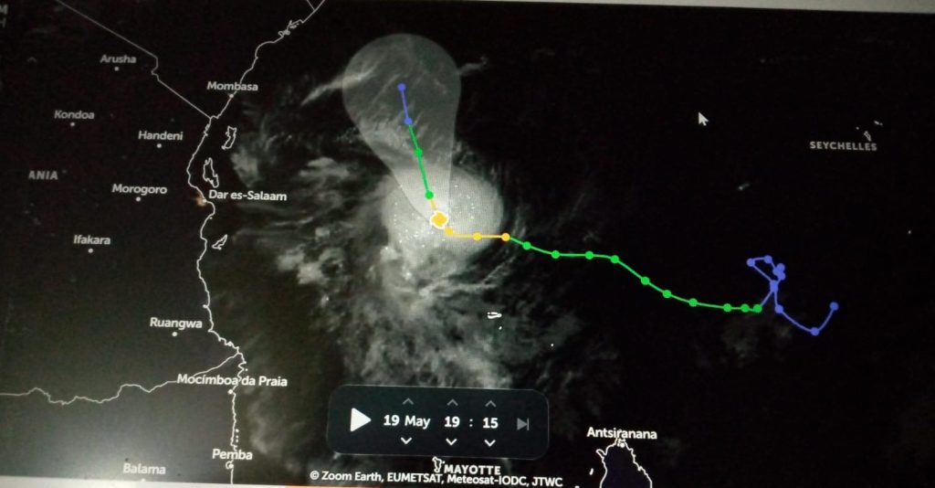


NAIROBI, May 20 (NNN-KBC) — Tropical Cyclone Ialy which formed in the Indian Ocean south of Seychelles on Tuesday last week moving at 35 kilometres per hour has gained strength and is currently a severe Tropical Cyclone moving at 100 kilometres per hour.
According to the tracking system and Climate Scientists, Tropical Cyclone Ialy is expected to reduce in intensity beginning Monday morning to a moderate Tropical Storm at 95 kilometres per hour.
What is different between Tropical Cyclone Ialy and its sister Hidaya is that its path is northwards towards the equator and will move to close to 3 degrees South before dissipating at a low speed of 55 kilometres per hour.
The eye of the storm will not make landfall and will end in the sea. The cyclone is accompanied by strong winds hence the need for those engaged in fishing to be cautious.
The Kenya Meteorological Department in a heavy rainfall advisory released on Sunday indicates the possibility of heavy rainfall through to Wednesday.
In the advisory, there is a forecast for rainfall of more than 30 millimetres expected in 24hrs over several parts of the country including; the Lake Victoria Basin, the Rift Valley, Highlands West and East of the Rift Valley including Nairobi area.
“The heavy rainfall is predicted to intensify to more than 40mm in 24hrs over the Rift Valley, Highlands West and East of the Rift Valley including Nairobi area, Lake Victoria Basin and off the coast on 20th to 21st May, 2024,” says the statement released by the Director of Meteorological Service, Dr. David Gikungu and adds, “It is likely to reduce in intensity on Wednesday but will intensify along the coast and last until Friday.”
The Weatherman is warning that the heavy rainfall is likely to be accompanied by gusty winds, large Ocean Waves in the Indian Ocean and strong southerly winds in the eastern region.
The counties expected to be affected include; Kisumu, Homabay, Siaya, Migori, Busia, Kisii, Nyamira and Nandi. The others are Kericho, Bomet, Kakamega, Vihiga, Bungoma, Narok, Baringo, Nakuru, Trans-Nzoia and Uasin-Gishu. The rest are; Elgeyo-Marakwet, West-Pokot, Turkana, Samburu, Nyandarua, Laikipia, Nyeri, Kirinyaga, Murang’a, Kiambu, Nairobi, Machakos, Kajiado, Mombasa, Tana-River, Kilifi, Lamu, and Kwale.
The Weatherman is urging the public in the areas mentioned to be on the lookout for potential floods, flash floods and poor visibility.
“The water levels in rivers, lakes and dams is expected to remain high,” says Dr. Gikungu and adds, “Residents are advised to avoid driving through, or walking in moving water or open fields and to avoid taking shelter under trees or near metallic window grills so as to minimize exposure to lightning strikes.”
“People in landslide-prone areas especially over hilly areas should be vigilant. Strong winds may blow off roofs, uproot trees and cause structural damages. Large waves may affect marine activities” warned KMD. — NNN-KBC