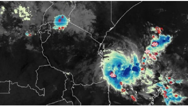
DAR ES SALAAM, May 4 (NNN-AGENCIES) — The Tanzania Meteorological Authority (TMA) cautioned people living in the country’s coastal region of strong winds and heavy rainfall associated with Cyclone ‘Hidaya’.
Cyclone ‘Hidaya’ comes due to low pressure which is associated with strong winds and heavy rainfall.
A former tropical depression over the South Indian Ocean north-northeast of Comoros strengthened on Wednesday, and Meteo France La Reunion designated the system as Tropical Cyclone Hidaya.
The authority also advised civilians to continue monitoring weather forecasts and heeding to precautionary information given.
A TMA statement issued on Friday said Cyclone ‘Hidaya’ was being tracked on the Indian Ocean’s eastern coast of Tanzania, noting the hurricane has continued to intensify towards the region.
“By 9:00 am on Friday, it had further strengthened and reached the status of a full-fledged cyclone, approximately 401 kilometres east of the coast of Mtwara,” read part of the statement.
TMA also said the trajectory of the weather systems at sea still indicates a high probability of cyclone ‘Hidaya’ maintaining its full cyclone status for the next 12 hours while escalating and continuing to approach the Tanzanian coast.
The authority further said the cyclone is expected to persist until May 6.
A TMA statement issued on Thursday said the cyclone is expected to cause heavy rain and strong winds in some regions.
“The regions include Mtwara, Lindi, and Coast (including the Mafia Islands), Dar es Salaam, Tanga, Morogoro, Ugunja, and Pemba regions and neighbouring areas,” read part of the statement. — NNN-AGENCIES


