PRETORIA, Feb 14 (NNN-SANEWS) — The South African Weather Service (SAWS) has warned that persistent and heavy downpours are expected to continue, especially over the lowveld and along the escarpment areas of both Limpopo and Mpumalanga.
“These areas have seen significant rainfall amounts the last few days and further severe impacts may occur, especially over the Mopani and Vhembe Districts of Limpopo until at least Tuesday, 14 February 2023,” SAWS said on Monday.
This will result in prolonged strain on disaster management and emergency personnel.
“Current high-resolution numerical models suggest further 24-hour rainfall accumulations of 100 to 200 mm, especially along the escarpment of Limpopo on Monday and Tuesday.
“Other areas in Limpopo and Mpumalanga will also see showery conditions, which may result in flooding because soil moisture content is high, and catchment and river systems are full,” SAWS said.
The easterly wave is expected to continue influencing the north-eastern regions of the country until Feb 14 over the eastern parts of Limpopo and Mpumalanga with the surface trough over the western interior continuing to create a convergence zone east of the country.
There is a high chance of thunderstorms developing over Gauteng and eastern parts of the North West province, which will bring about heavy rainfall with an impact of flooding expected on Feb 15.
“The easterly wave is expected to subside from Feb 14 in the evening with the intensity of prolonged rainfall gradually tailing off. However, scattered to widespread showers and thunderstorms are still expected for the remainder of the week for a large portion of the country,” SAWS said.
SAWS will continue to monitor any further developments relating to these weather systems and will issue subsequent updates as required.
During the latter half of last week and continuing through the past weekend, a slow-moving upper-air cut-off low-pressure system lingered over the interior, causing widespread and often heavy rain over the eastern and north-eastern provinces.
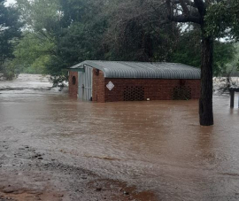
“This extreme rainfall resulted in widespread flooding, with major rivers (especially those transiting the Kruger National Park and lowveld) now being in full flood since the beginning of the weekend.
“The escarpment and lowveld regions of the Limpopo province and particularly the Mpumalanga province have borne the brunt of the flooding, with the southern half of the Kruger National Park particularly affected.
“Many low-water bridges and causeways (including the Crocodile bridge and the causeway at Lower Sabie camp) are flooded, while numerous main roads, including the main road linking Skukuza to Lower Sabie are closed due to flood damage,” SAWS said.
Moreover, the presence of an additional low-pressure system over southern Mozambique and northern KwaZulu-Natal significantly elevated the risk of flooding along the KZN coastline for Saturday night, prompting SAWS to broaden the Orange Level 9 Impact-Based warnings to include a significant portion of eastern KZN.
The public has been urged and encouraged to regularly follow weather forecasts on television and radio.
Updated information in this regard will regularly be available at www.weathersa.co.za as well as via the SA Weather Service Twitter. — NNN-SANEWS


